
 Expeditions Unlimited blog
We set off to climb Kun (7077 m) in the Great Himalayan range, in Ladakh. Its ascent follows the north-east ridge, offering a technical route with few objective hazards. A gradual approach culminating in a trek and the crossing of the Kanji La at 5280 meters allows for acclimatisation. Two full weeks are dedicated to the ascent, with a few reserve days in case of bad weather. Three high-altitude camps are then required to climb the mountain, an ascent we describe in this article. The favourable period to climb Kun covers the months of July, August and September.
View our Kun ascent offering, next guaranteed departure on August 3, 2025
Find all our high mountain expeditions above 7000 meters
The ascent comprises four distinct phases
Towards Camp 1
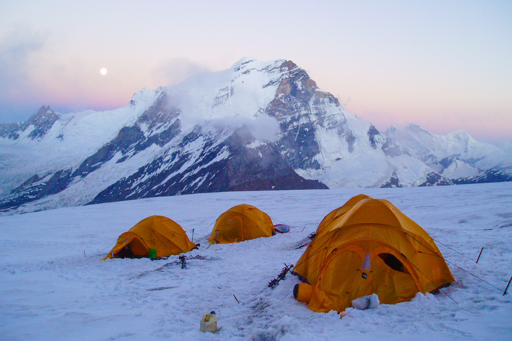
Advanced camp on the Kun ascent in the Indian Himalayas © Jérôme Brisebourg
The ascent of the large couloir leading to the vast plateau separating Nun and Kun: we climb for 2 to 3 hours along a moraine leading to the foot of the Shafath glacier. A route through numerous crevasses leads to the foot of the couloir leading up to the great plateau. Camp 1.
The ascent of the large couloir to Camp 2
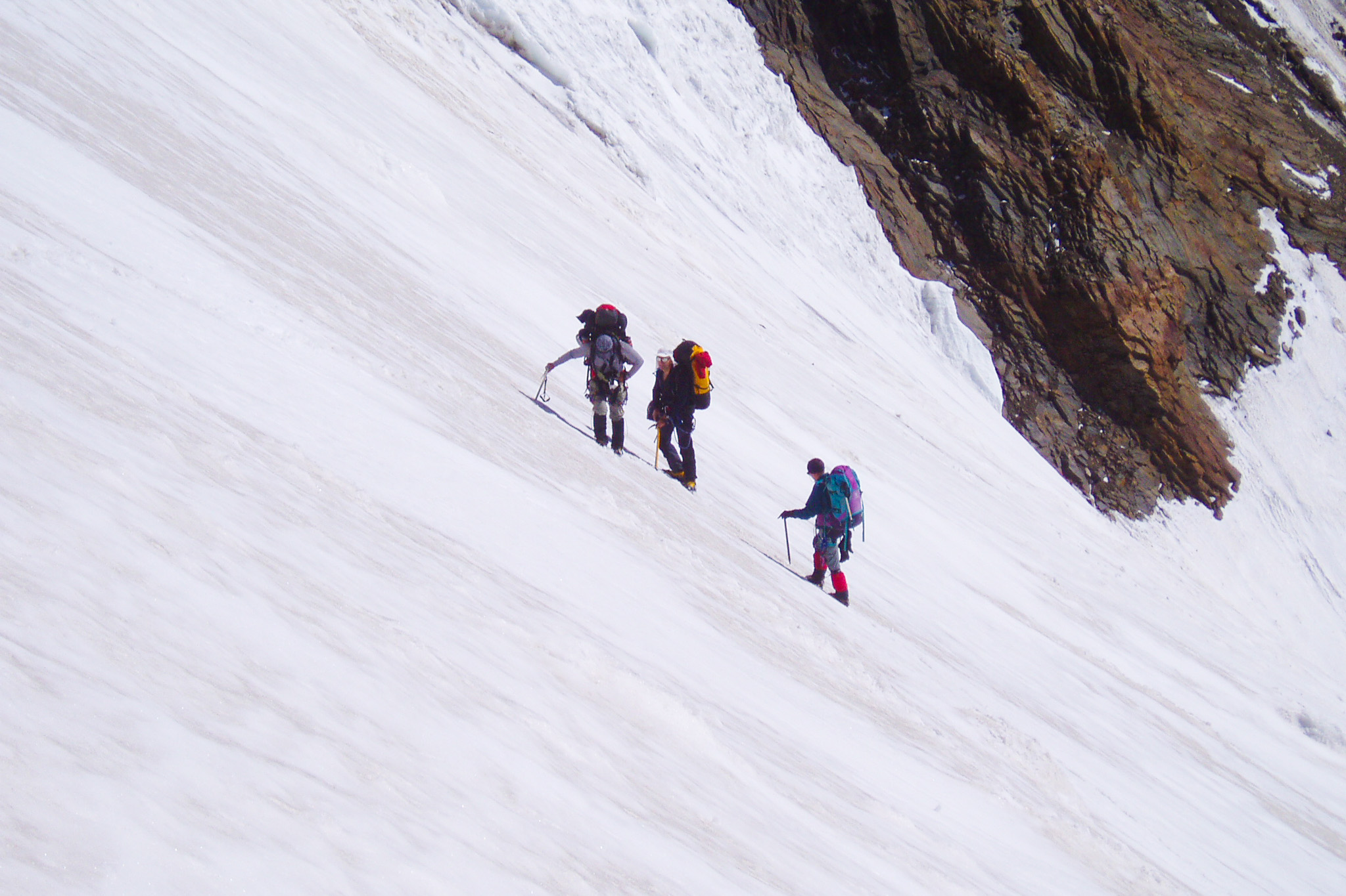
Slope on Kun in the Indian Himalayas © Jérôme Brisebourg
We then reach the most technical section of the ascent. A mixed and ice couloir with an average incline of 45° leads to the Snow Plateau. The guides fix ropes along the entire length of the couloir to facilitate progress. At the top of the plateau, we finally discover Kun and Nun (7135 m) on our left. The south-east face of Kun, entirely rocky, will need to be skirted in order to finally catch sight of the route leading to the summit.
The crossing of the great plateau to Camp 3
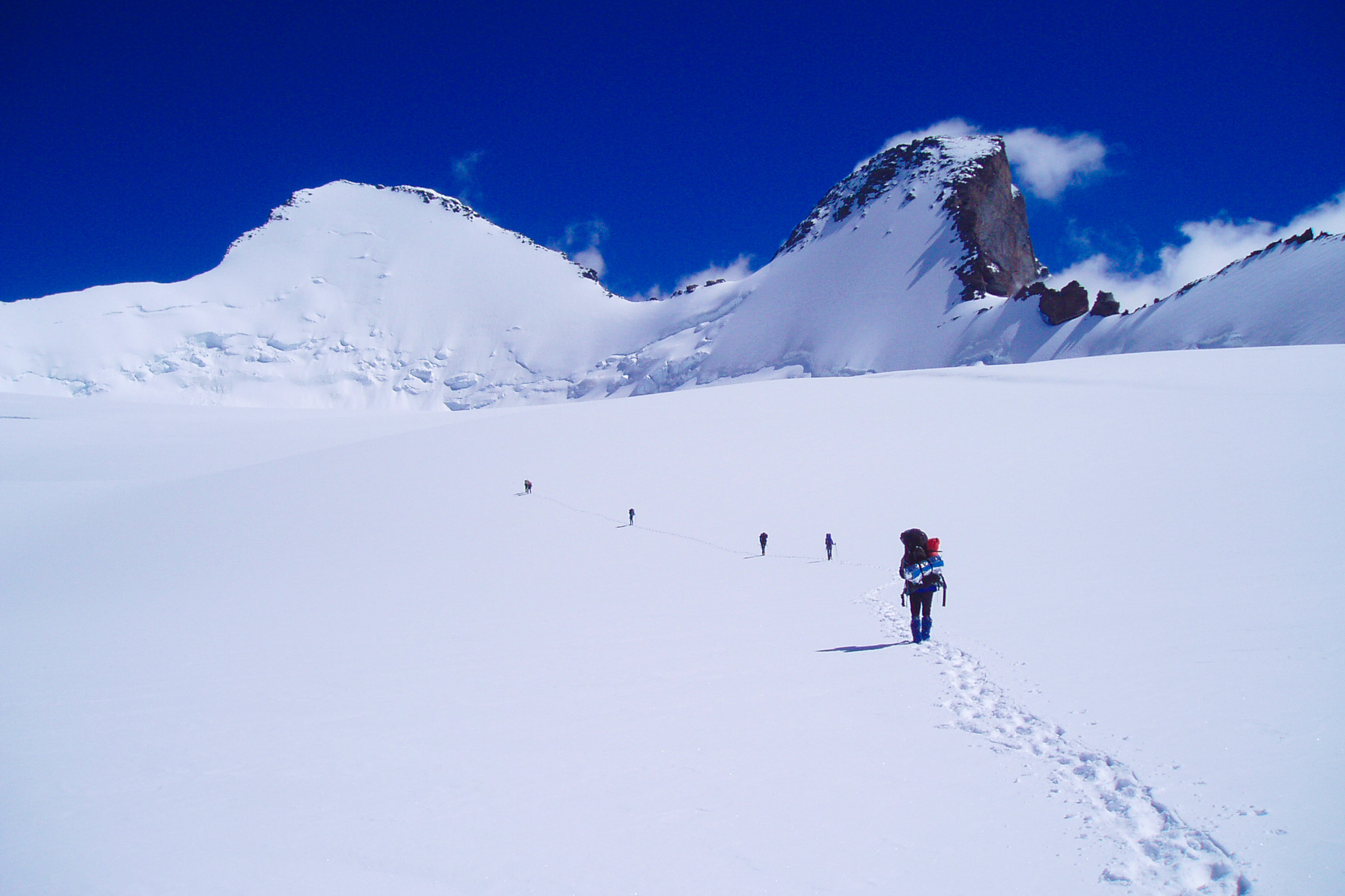
Kun in the Indian Himalayas © Jérôme Brisebourg
The crossing of this vast plateau stretching three kilometers: three kilometers of tedious flat terrain. The day's weather can make it very gruelling: in fine conditions, it quickly becomes very hot; conversely, the wind can blow violently. It is advisable to place markers along the entire route to find one's way back easily in case of bad weather on the return. Little by little, the north-east face reveals itself, and the continuation of the route becomes clear.
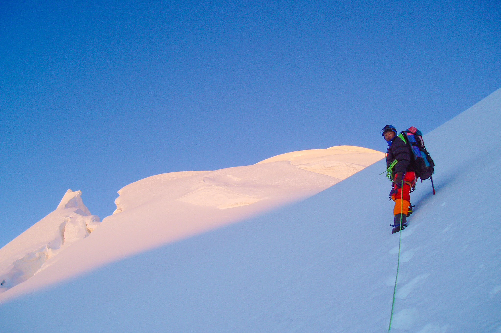
The progression along the north-east ridge to the summit
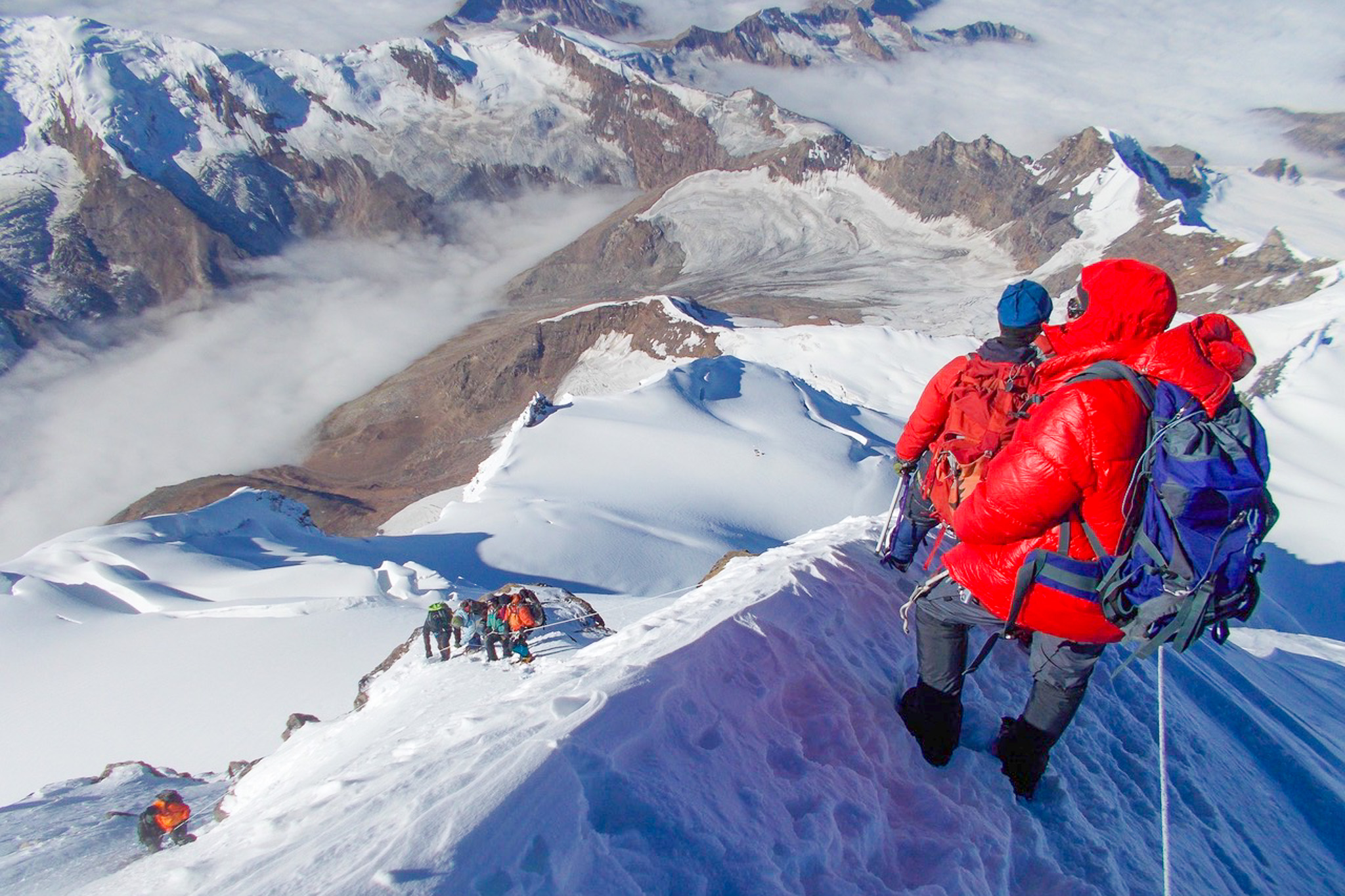
Climber on a ridge of Kun in the Indian Himalayas © S.Dawa
The progression along the magnificent north-east ridge, in a vertiginous setting: the route begins by climbing 40° snow slopes to reach the broad col at 6500 meters, separating Kun from Pinnacle Peak (6930 m). We then follow the north-east ridge, with a dizzying view down the opposite face. The ridge, inclined at 35/40°, may present short, somewhat steeper steps. The difficulty depends greatly on the quality of the snow and ice. In some years, almost the entire ridge must be equipped with fixed ropes.
Level required for the ascent of Kun, a Himalayan summit at 7077 meters
Guide during the ascent of Kun in the Indian Himalayas© Jérôme Brisebourg
What physical and mental level is required?
Significant mountain experience is required, along with an active practice of hiking, trekking or mountaineering in order to be as self-sufficient as possible. This programme is aimed at participants in very good physical shape, with a significant sporting background, particularly in endurance activities, and an excellent mental fortitude enabling them to cope with difficulties that are by nature unforeseen. Good physical and mental preparation is essential, given the effort required at high altitude and the hostile environment (remoteness, cold, bad weather, discomfort), in order to optimise the chances of success. A team spirit is also important. Each participant is responsible for applying safety rules, for their equipment and its maintenance, for setting up camp and for meal preparation. As always in this type of project, the key to success lies in the collective effort and team spirit.
What level of mountaineering is required?
To complete the ascent of Kun, the use of mountaineering equipment (crampons, harness, ice axe, ropes, etc.) is necessary, and the route tackled may involve already significant difficulties, whether in terms of sections at 40/50° on a glacier route, grade 3 climbing on a low-height rock face, the commitment of the climb and the continuity of effort required. From a technical standpoint, this route is graded AD – Fairly Difficult in mountaineering terms. Comfort on snow slopes of 40/45° is required, and experience of high-altitude expeditions is necessary. Knowing how to move as an independent rope team or roped up with the guide, and being familiar with rope handling, is essential. It is therefore aimed at participants already experienced in mountaineering who have already completed a few routes at this level or slightly below. This technical grade applies of course to normal weather conditions: the difficulty can increase in poor conditions, with fresh snow on a rock route, insufficient or poor quality ice on a glacier route, etc. Likewise, the situation changes radically, for the same technical level, with altitude, the weight of the pack, the limited fixed equipment on the route, fatigue linked to a long approach, the particularly hostile environment, etc.
Our preparation courses and our medical hotline
Mountaineering preparation courses within the framework of our École de l'Aventure can be a serious asset, both for building confidence and gaining autonomy. In addition, we offer a medical preparation course for high altitude and extreme cold with Ifremmont in Chamonix. Participants in this ascent benefit, throughout the duration of the expedition, from membership of the 24/7 high-altitude medical service set up with our partner Ifremmont. Furthermore, we provide a live tracking system allowing the progress of the climbers to be followed in real time.
An example of live tracking: Ama Dablam 2024
